Tuesday, December 2, 2014

Fort Mountain: Hiking the Stone Wall, Tower & Overlook Trails

After going to Amicalola Falls the last time, I decided to go to North Georgia again to see what else nature has to offer.
I particularly remember seeing a sign for Fort Mountain on Hwy 52 on our way to Amicalola, so that's where we decided
to go to next! It was slightly further than I thought it would be, but it was worth the drive. 


Fort Mountain is part of the Chattahoochee National Forest in Murray County near Ellijay, Georgia.  Fort Mountain Park offers many activities suited to different preferences, specifically hiking trails, mountain biking, horseback riding, and many campsites. Featuring over 14 miles of trails within the park, we chose to hike a shorter one by combining three trails while still being able to see the scenic aspects of it.


From the parking lot, we followed the trail through the forest to get to get directly to the overlook.
The trail was not too difficult while it still provided this beautiful panoramic view of the mountains and fall's beautiful colors. 


Our hike was relatively short this time around, being just about 2 miles. We wanted to take an easier hike in order to
fully enjoy the scenery and relax before it becomes hectic with group projects, finals and graduation around the corner.
Although it was a shorter hike, it was still a refreshing sense to come to Fort Mountain this week.


Thursday, November 27, 2014

Raven Cliff Falls


The Raven Cliff Falls trail is located on the Chattahoochee National Forest near Helen, Georgia. Being only about an hour and a half from Atlanta, Raven Cliff Falls is worthy of the moderate-long drive. It is a popular destination for hikers, being that we went during the week and there were more hikers than I anticipated. It is also a popular camping site for many. Throughout our hike, we noticed quite a few signs warning visitors to be aware of black bears by not having food out and staying away from them. There are other scenic trails near Helen including High Shoals Falls, Tray Mountain, Byron Reece Trail, Duke Creek Falls, among others.

Raven Cliff Falls is a 5 mile scenic trail following the Dodd Creek upstream in a shady and mossy forest leading to the beautiful waterfall within a 400 feet sliced rock outcrop.The trail begins near Dodd and Bear Den Creek, it is hard to miss with all of the signs leading the way. One of my favorite things about the trail was the fact that it truly is scenic throughout, from small cascades to an overlook and of course the waterfall within the cliff!


The inclined hike was moderately difficult for me being 5 miles going up for the majority of it, but the inside view of the waterfall was well worth the at times strenuous parts of the hike. 


Beautiful overlook, isn't nature just beautiful? 


I absolutely loved Raven Cliff Falls and intend on coming back to North Georgia to explore the other scenic trails it has to offer!


Tuesday, November 18, 2014

Amicalola Falls


Amicalola Falls Trail is in Dawsonville, GA and is part of the Chattahoochee National Forest. Amicalola is actually what motivated me to start hiking and exploring Georgia's nature while at it. I had seen quite a few of my friends' posts on Facebook and Instagram and I couldn't believe Georgia had such beautiful waterfalls! I've been itching to come to Amicalola for months, but decided to wait until the leaves changed colors in order to enjoy the beautiful fall scenery. 


The trail itself is only sightly over 2 miles, but due to the steep climb to reach the top of the waterfall, it feels a lot more difficult than I anticipated.  The gravel incline felt a lot more than one mile since it was 725 feet in elevation from the trail-head! When we reached a parking lot at the top, we felt alleviated because we could now hear the rushing waterfall nearby, so we knew we were close! 


Past the parking lot, we found a bridge that was over the crest of the waterfall and featured this beautiful view of the mountains covered in fall's beautiful colors. 


Immediately after the wooden bridge, we found many sets of wooden stairs that go along the waterfall.


Although the sets of stairs were moderately difficult, having the beautiful scenery and being able to hear the waterfall so close made it more enjoyable! 


Amicalola was just as beautiful as I anticipated, maybe more! And I was not the only one admiring its' beautiful scenery, there were some photographers there taking pictures. There was even a bride and groom taking pictures by the waterfall! I absolutely loved it and will definitely be coming back to Amicalola and the parks nearby that I noticed on our way to Amicalola Falls. 


Thursday, November 6, 2014

Cochran Shoals Park

Cochran Shoals Trail is part of the Cochran Shoals section of the Chattahoochee River National Recreation Area. There is also another park on the opposite side of Cochran Shoals Trail called Powers Island. We initially planned on going to Powers Island, but when we passed the entrance and found Cochran, we decided to just go ahead and check it out! 

Cochran Shoals is off of 285 near 75 on Interstate North Parkway, conveniently close to me! The trail is about 3 miles mostly through gravel, big shady paths, and along the river. Cochran Shoals is very popular among walkers, runners, and hikers a like. We went in the morning and there were already a lot of people walking, running, and with their pets. Because the whether is getting a bit cooler, I decided to take my dog Toby with us and he loved it! 

Meet Toby!

A great thing about Cochran Shoals aside from the accessibility, easy stroll, and wildlife, is that it is very dog friendly! There were so many walkers and runners with their dogs. There were even some doggies with Halloween costumes (we went a few days before Halloween)! Toby being the goofball that he is, wanted to play with absolutely every dog he came across and wanted to play with every kid that came near. Cochran Shoals Trail also had a dog fountain next to the water fountain that Toby was ready to tackle as soon as he noticed it. 

Hello huge fish!

After walking for about half a mile, we noticed a lot of people crowded around the edge of the river. Naturally, we got curious as to what they were looking at. Everyone was looking at the ducks and the huge fish below them! These fish were probably about a foot long! I don't eat seafood, so it wasn't enticing to me, but there was a guy there who ran to his car to get his fishing rod in efforts to catch some. 


Wednesday, October 29, 2014

Kennesaw Mountain Battlefield

Rich history, high elevations, and Scenic Views


Kennesaw Mountain Battlefield park offers over 15 miles of hiking/running trails with history and scenic views in its nearly 3000 acre National Battlefield. The Kennesaw Mountain Battlefield preserves a Civil War battleground of the Atlanta Campaign. Opposing forces maneuvered and fought here from June 19, 1864 until July 2, 1864 (NPS). Its rich history is evident from the moment you arrive. The first thing we noticed when we arrived to the Visitor's Center was a cannon. I've never seen a canon outside of a history book, so it was interesting to see. 


I was initially planning to walk one of the trails surrounding the mountain since I was not really feeling up to the challenge of hiking up the mountain after being sick for the past week. However, after much deliberation with my brother, he convinced me to go up the mountain instead. Of which I'm glad he did despite my lack of energy. For had I not gone up the mountain, I would have missed out on seeing the canons at the top, the accomplishment excitement, and of course the top of the mountain summit view. 

Sluggish beginning


Unlike Stone Mountain, Kennesaw Mountain quickly rises in elevation. From the moment we found the walk-up trail, it was already more of an incline in comparison to Stone Mountain. In Stone Mountain, it is a gradual increase in elevation from the walk-up trail entrance as compared to Kennesaw Mountain where it immediately increases in elevation. Perhaps my lack of energy from being sick could have had something to do with my perception of tiredness, but this hike has been the most physically challenging for me.

During my previous hikes, my mantra has been to keep going and not stop until I've reached the top/end. For this hike however, I had to take a couple breaks. When we were about 2/3 of the way up, my calf muscles felt tense, I kept coughing and felt out of breath. At one moment, I considered letting my brother go to the top while I wait for him there. However, I did not allow myself to quit, instead I took a longer break and then decided to get back up and keep going. After my break, I felt more energetic and better about the hike. I guess it's true, its all about your perspective/attitude. Before I knew it, I realized we were near the top! 


View from the top of Kennesaw Mountain


It was all worth the sluggish beginning and tiresome hike once we reached the top and were able to see the views from 
the top! I was so glad I decided to keep going despite my lack of energy. 


Alternate route 


Just as we were getting ready to go back down the mountain, we noticed people going in two different directions. We decided to take the alternate route in order to be able to experience both routes. The road route is about .5 mile longer than the walk-up the mountain trail. Most people taking this route were bikers or runners. There was also a shuttle that brings visitors to the top of the mountain without the hike. 


Amateur Lessons:

  • When recovering from being sick, go on an easier hike. It seems like common sense to many, but for me, I thought that since I felt better, I'd be fine to go on this hike. 
  • Go to the restroom before you go on the hike. I thought there would be some restrooms at the top, like Stone Mountain.  
  • Attitude is everything! 


Tuesday, October 14, 2014

East Palisades Trail

Up close and personal with nature, confusion, and scenic views. 

The East Palisades trail is part of the Palisades segment of the Chattahoochee River National Recreation Area. The 3.8 mile hike features high elevation overlooks, mill ruins, and an interesting bamboo forest (what drew me in to go on this hike!). It truly is a nature-filled, scenic hike without venturing out too far from Atlanta. After immersing into the beauty that the Chattahoochee offers, you can actually forget that you are so close to the city! I became so immersed with my hike that I only remembered the city when I reached one of the overlooks and I saw some tall buildings from there. East Palisades is perfect in that it can be a moderately difficult hike, offering some scenic views and so close to 285 and I-75. 

 And the confusion begins 


The East Palisades' trail-head begins at the end of the Indian Trail NW street. I initially passed the Indian Trail NW street from NorthsideDr. since it just seems like a high-end neighborhood. There was no sign indicating the East Palisades Trail-head ahead.

After driving for about a quarter of a mile, there was no longer a paved road, but rather a rocky road. Soon after, we found a small sign of the park. The unpaved road is narrow, only accommodating one car at a time. And when I saw some people running, I questioned whether I was even allowed to go there. My worries dwindled when I finally found other cars parked at the end of the road. Yay!!! 

Hello National Geographic in real life! 

Literally upon arriving to the trail, a hiker excitedly informed us of a snake on the trail. We were about 15 feet away from her, had just arrived after being confused for 10 minutes and a stranger is talking about a snake? I looked at my 16 year old brother, waiting for his head nod to the car but instead he starts darting towards her! I give my brother a "are you crazy?!" look, but it's too late since he's already by her side.                                        
                                                                                                        I asked the lady where it was as I walked slowly, dreadfully near her. My brother reaches her and then amazed tells me "Hurry Liz! The snake is eating the frog!" as he takes out his phone and takes a picture of it. I'll admit that at first, I refused to get within 5 feet of the snake. But when I saw that it wasn't moving since it knew it had an audience, I felt slightly at ease. I, like most of the population, am afraid of snakes! But according to the other hiker, the snake is not venomous and was too "busy" to even bother with humans. Phew!    

Chattahoochee River 

After passing the snake's lunch break, we officially began our hike! I don't like being in the sun much since I get hot easily and then frustrated (my brother says I'm like our husky-german shepherd dog!). So I loved the fact that probably about 90% of the hike was in the shade! After hiking in the forest for what seemed like 15 minutes, we suddenly heard the rushing water of the Chattahoochee River.


Higher elevation to finally reach the Bamboo Forest!


After passing the Chattahoochee River, we continued our hike in search of the Bamboo Forest. Parts of the trail were steep and narrow. My brother likes to lead the way, so in parts where it was narrow, he was the leader. Every so often, my 10 year old sister would ask if we were close to the Bamboo Forest. We told her that she could see the pandas there, she didn't believe us at first, but my brother's poker face convinced her. My sister is a huge animal advocate so she was anxious to reach the bamboo forest despite the fact that she was tired. We took breaks with her every half mile and after listening to her ask about the pandas for 20 minutes, I had to tell her we were just kidding.


I had no idea there was a Bamboo forest so close to home! I've never seen bamboo, so seeing it with my own eyes was definitely fascinating. I wanted to continue hiking the remaining .7 mile of the trail to reach the overlook. Unfortunately, I once again made the mistake of going for a hike later in the evening so the sun was starting to set and my sister was tired and hungry. Next time I go, I will ensure to hike the entire trail to reach the overlook!

Thursday, October 2, 2014

Sweetwater Creek State Park


Deer, History, and rushing Whitewaters 

Sweetwater Creek State Park is a nice little escape from the city-life without the long drive. Being only 20 minutes away from Atlanta, these 9 miles of hiking trails run along the Sweetwater Creek and into the forest featuring beautiful nature along the way. The Red, Yellow, and White Trails are the three main hiking trails varying in distance and scenery. All trails start from the main entrance by the Interpretive Center. The Interpretive Center includes exhibits of the Civil War, plants and animals found in the park, water, restrooms, and snacks. 

My friend Berlin and I decided to go on a longer hike this time around. Being the anxious amateur hiker that I am, I did not hesitate to take on the challenge of hiking the 5.2 mile White Trail. 5.2 miles may not sound like much to experienced hikers or regular runners, but for me, 5.2 is a jump from my usual 3 mile walks/jogs. Luckily for me, I was mesmerized (mostly by the deer) with the scenery that I didn't even realize I was getting tired until we reached the last half-mile, which at that point, the mentality was "Almost there! Push through!" 

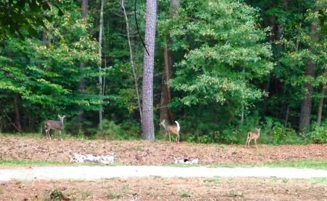
 Meet Bambi and his little family

As we arrived to the park, we were greeted by four deer just hanging out by the Interpretive Center, right at the trail-head. The only encounters I've had with deer in the past have been when we have gone to my aunt's house in Newnan, where I've seen their eyes glow in the dark, or sadly, their corpse along the side of the road. This had been the first time that I've been close to any. Both Berlin and I were too excited to see them, maybe a little more than I'd like to admit. After stalking the deer for about 2-3 minutes, we decided to go ahead and hike the White Trail. 

New Manchester Mill Ruins 

After hiking for a mile, we reached the historic New Manchester Mill Ruins building and the intersection with the Red Trail. The information posted at the park indicated that it used to be a 5 story with a basement brick factory before it was destroyed during the Civil War by the Union troops on the march to Atlanta. 


On the right side of the Manchester Mill ruins are these long wooden stairs that take you to the creek once again. The stairs offer a different perspective of the building. I would have liked to have access to go inside the fence and get a closer look at the ruins from within, but alas it was still interesting to see. For those interested in seeing the ruins closer, the park offers excursions with a ranger on certain days by appointment.


Sweetwater Creek State Park has been my favorite hike thus far! From seeing Bambi and his family to the rolling forest, creek, and the Manchester Mill Ruins, I loved it all! It was moderately difficult for me distance wise, but the elevation was steady for the majority of the hike. We decided to take a break at the creek before it deviated from it and into the forest once again. The rushing water, the birds, and the deer were a relaxing panorama to take in for a while at the creek. Incredible how something so relaxing and full of life is a merely 20 minute drive from Atlanta!  

Tuesday, September 30, 2014

Stone Mountain


For my next adventure, I decided it was time to go back to Stone Mountain! I have been to Stone Mountain about 3 times in my entire lifetime, and considering I moved here from Texas when I was one year old, it was time to go back. Of those 3 times, I walked up Stone Mountain for the first time last summer. The other two times, I went with my family to Stone Mountain Village for the fireworks around the 4th of July and the other time for the laser show during the holidays. Both of which are great times to go by the way!

Walking Up Stone Mountain is free, you only have to pay for parking. Parking is $10 per day or you can purchase an annual pass for $35. I only had $15 on me so I had to buy the daily pass, otherwise the $35 pass would've been a great deal, especially since we plan to go again! The Walk-Up Trail is open from sunrise to sunset, I like working out in the morning, so we went around 10 AM. The Walk-Up Trail is about one mile and from the top, it is 1686 feet above sea level (Stone Mountain Park). The trail is marked by a yellow line so it is easy to remain on track and enjoy the views along the way. I loved the fact that there was plenty of shade for most of the hike (with the exception of the steep part of course). 

My brother David loves going to Stone Mountain so it seemed ideal to take him with me. Before embarking on our hike, he challenged me to not stop for a break until we reached the top. My brother and I are extremely competitive individuals. So being challenged helped me keep pushing even when the hike became difficult. Considering he is taller than me, it was challenging to keep up with his fast pace, but I pushed through. 

The first time I walked up Stone Mountain, I took a break by the picnic area and again right after the steepest part of the hike where the metal bars are located. This time around, it was tempting to take a break right after the steep part, but I pushed through! I wanted a picture of the steep part, but I decided to wait until we were on our way back down to snap a picture of him there. I am so glad I did, because I had a great sense of accomplishment when we reached the top without stopping! 


Together we made it!


Making it to the top without stopping was challenging, but  worth the endorphin/adrenaline rush obtained from our hike up Stone Mountain! I was surprisingly full of energy when we made it, perhaps it was the adrenaline or sense of accomplishment, but I was filled with so much joy and energy that I wanted a picture in the air on top of Stone Mountain. 

When the energy started wearing off and the tiredness kicked in, it was finally time to take a break and enjoy the spectacular view from the top! It was so refreshing and relaxing to sit in silence and take in our view. Our view consisted of the Atlanta skyline and the North Georgia Mountains, and the surrounding Stone Mountain area. 
The top of the mountain's amenities include restrooms, water fountains, gift shops, and snacks.  

Something I learned from this hike: there are an additional 15 miles for hiking trails in Stone Mountain. We purchased the annual pass, so we will definitely have to go back and explore the remaining trails there! 


Friday, September 19, 2014

Vickery Creek Trail

And so the adventure begins... 

In search of a hiking trail for the first Amateur Hiking Adventure, I googled hiking trails with waterfalls in Georgia. I have never seen a waterfall before, therefore it seemed fitting to go hiking at a trail with a waterfall first! Through my search, I discovered three great sites that I will likely refer to in future adventures: Atlanta Trails, Georgia Trails, and Georgia State Parks. For this first adventure, I wanted to explore a hiking trail with a waterfall that is relatively close to me. Most of the trails that I found were about 1 hour to 2 hours north of Atlanta. Surprisingly, I found Vickery Creek Trail in Roswell, which is only about 15 miles from my house! Vickery Creek Trail is a 3 mile hike through the rolling forest and banks of Big Creek. The hike offers beautiful scenery from the old mills, to a covered bridge overlooking the Big Creek, fallen trees, and finally to the waterfall! 

My friend Berlin and I entered the Vickery Creek Trail through the Mill St. parking lot. Berlin said that she had been hiking at one of the nearby trails but had no idea there was a waterfall in this one particular hiking trail. Once we parked the car, we were ready to get started! The first thing we saw when we arrived to Vickery Creek was the pretty entrance that lead to a steep concrete incline. After going down the incline, we saw the historic Mills Ruins building. 


Entrance 
Mills Ruins


On the left side of the Mills Ruins was a long covered bridge over passing the Big Creek. From inside the bridge, visitors are able to take in the scenery of the Big Creek, the trees, and the trail up ahead. 

Inside of the covered bridge 

Past the the covered bridge, we found a flight of steep stairs that lead to the trail. The trail was too narrow to allow us to walk side by side for the majority of the hike. Which was fine since it allowed Berlin, the more experienced hiker to lead the way. I am not the most coordinated person out there, so having her lead the way was great for me to know what to be cautious about, what avoid, and upcoming terrain changes. 

The hike was moderately difficult, but not as difficult as I had first anticipated. Parts of the trail that felt more difficult to me as an amateur were the steep parts. However, it was totally tolerable and enjoyable! As my brother says "No pain, no gain". My two favorite aspects of the Vickery Creek hike was encountering the two fallen trees and the waterfall! 

Between two fallen trees
By the time we reached the waterfall, we were sweaty, tired, and ready for our snack. Fortunately, the waterfall was as great as I had anticipated! The waterfall was beautiful and the breeze was refreshing. It was the perfect place to take a break and eat our delicious, crunchy, fresh from the Farmer's Market peaches! Not sure if it was because we were hungry, but that peach was the best peach I've ever had.   


Amateur Mistakes:

The first rookie mistake I made was not giving myself ample time for hiking. I read that the trail itself is about 3 miles so I figured the most it could take would be 45 minutes to an hour so we went around 6:30 PM. For those who live in Georgia know that September's weather can be misleading in that it can be sunny and high in the 90s during the day and then suddenly rain in the evening. I for one, am not a big fan of the heat, so I thought hiking later in the day would be perfect. Unfortunately, I did not take into consideration the things that could go array on a first hiking adventure. Hiking at that time proved to be a mistake since we made wrong turns that only got us lost and before we knew it, it was dark and we still had not found our way back to the parking lot. 

Which leads to mistake number two: not reading the map properly. When we first arrived to the trail, I saw the map,  but since I saw that it practically looked like a loop, I figured "just go with the flow, eventually, we'll find the waterfall". NOT A GOOD IDEA! My plan was to loop around the entire trail, but simply making a wrong turn made us loop within the bigger loop of the trail. It seemed as if we had to make decisions between two or three paths, I would look at the map and choose the one I thought would be the correct path to take us back to the path we wanted to take. And more often than not, it turned out to be the wrong one. 

To add to the suspense of trying to find our way back to the parking lot in the dark, after being lost for a good 30 minutes, I was running low on water. Mistake number three: not taking enough water. I brought a small 20 oz water bottle. I tend to feel dehydrated rather quickly so I always carry water with me. Since it was dark, we were lost, and I was low on water, I became nervous. Luckily enough, we finally reached one of the marks we had previously reached and from there we found our way back! 

For future hiking adventures: go earlier, study the trail map ahead of time, take a bigger water bottle!  

Thursday, September 4, 2014

The Amateur

Hello fellow Amateurs (or Experts), 

Welcome to my blog! I'd like to start off by telling you a little bit about myself. My name is Elizabeth, I'm a 23 year old from Georgia about to graduate from college in a few months! As the title suggests, I am an amateur-hiker-wannabe but I am okay with it because I would like to become an experienced hiker someday and be able to travel and see what this beautiful mother earth has to offer! And what better way to start than in my own hometown? I have never hiked, in fact, the closest I have gotten to hiking has been walking Toby, my Husky-German Shepherd at the park. Therefore, when I say amateur, I really mean it (for now). This is also my first ever blog, so to say I'm excited for the next chapter in my life would be an understatement! For in a few months, I will be a college graduate, blogger, and (hopefully) a hiker!

   What you can expect from my Amateur Hiker Adventures:
  • Photos of the trails/interesting things I find along the way
  • Details of the trails
  • Lessons learned (mistakes made) 
  • I have never seen waterfalls and I've heard there are some in Georgia (whaaaaaaat?) so I aim to explore some of them! 
  • I have seen friends post photos from mountains and they always seem so beautiful, so I will also hike those! 
  • Fall is my absolute favorite season, so (spoiler alert) I will try to capture the changes in the coming months. 


"Exploring Georgia one hike at a time"